Understanding the World of Surveillance, Modelling and Visualisation
The saying “time and tide waits for no man” could be easily updated to refer to technology and its relentless pursuit of continuous improvement. It was with this dynamic commercial landscape in mind that OSRL created a Surveillance, Modelling and Visualisation (SMV) position within the Technical Department; dedicated to driving the development, adoption and implementation of effective, technology-based solutions that can support OSRL, and its members, to better manage spill preparedness and response.
In this context, the SMV team has a strategic objective to meet the industry’s demand for smarter, technologically-advanced products and services within SMV’s integrated fields. As part of that objective, the team tasked with its delivery provides periodic updates on a wide range of technologies and their relevant application within the field of spill response.
In this update, we explain the latest technological developments and the results from recent testing and exercises for each of the major technologies OSRL is investigating, as well as highlighting the core purpose and possible application of the technology.
Kites
Not dissimilar to the type of kite you used as a child, or the larger power kites you may see being flown on beaches, surveillance kites can play a notable role in supporting containment and recovery operations, both onshore and offshore.
Through the inclusion of an HD camera able to output still images and video, kites can be transformed into a low-cost surveillance platform, capable of improving encounter rates by rapidly identifying the thickest patches of oil from the air.
In 2018, OSRL successfully trialled an operational surveillance kite, equipped with a gyro stabilizer to provide imagery and video with actionable value.
“Kites present a lot of opportunities for us and our day-to-day activity and help fill known gaps in our response toolkit. They have a number of inherent benefits over other solutions. They are low cost, easy to launch and operate – often with less stringent regulatory constraints – and we can use a simple mobile phone-based app to receive and share the kite’s output.
“What we’ve been looking at most recently are the use parameters. We needed to understand where and in what conditions we can use different sizes and types of kites so we can define a package for response operations. For example, we wanted to know what the maximum wind is the kite can operate in and how different levels of wind can impact a kite’s effectiveness. With that information in hand, we’ve been able to finalise the specification package for our members, so another objective met,” Pringle commented.
Aerostat
An aerostat is defined as an aircraft that gains its lift through the use of a buoyant gas and can include unpowered balloons or powered airships, which may be free-flying or tethered. In relation to OSRL, aerostats are typically unpowered and tethered to a vessel or the beach, much like a large balloon, equipped with an HD video and still image camera, and even an InfraRed sensor.
Sharing some of the benefits of kites, aerostats represent a low cost, easy to use surveillance tool. However, they are not without their limitations, with an inability to use in high winds being the most notable shortcoming.
“Just like kites, aerostats are not suited to all scenarios but where they are appropriate, they add another resource to our response capabilities. Weather is definitely a big factor in their use but in the right conditions, they provide a very simple route to gaining almost immediate aerial visibility.
“Right now, we are in the middle of developing the terms and conditions for call-off agreements with a number of aerostat providers, with the goal of having an aerostat permanently stored at our Southampton facility,” Pringle added.
Unmanned Aerial Vehicle (UAV)
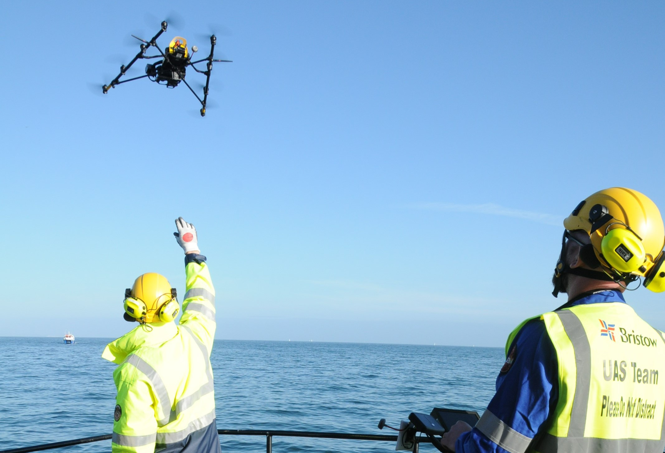
Globally, UAVs are playing an ever-bigger role in surveillance and monitoring activities across a broad range of industries.
In relation to spill response specifically, UAVs are capable of providing support for containment and recovery operations, shoreline surveys, post-treatment inspections or site security, to name just a few. One of the major benefits of UAVs relates to creating HSE advantages and cost efficiencies within almost every area of their operation. Understanding these opportunities have driven OSRL to invest in this area, expanding its member offer with the launch of a dedicated Unmanned Aerial Vehicle (UAV) service.
To facilitate the service on a global basis, and to ensure the shortest time to mobilisation, OSRL has recently signed ‘call-off agreements’ with a number of third-party UAV providers around the world. Each partner has been selected based on their relevant in-country experience, technical capabilities or geographical reach, and will ensure OSRL members have the most appropriate and effective solution to the specific challenge in hand, with the necessary flexibility to meet the broadest range of scenarios.
“The UAV sector is fast moving, with both the core technology and physical equipment constantly being upgraded. Equally, around the world, applicable regulations for the safe use of UAVs differs significantly and changes regularly. In light of these challenges, we decided that the best way to integrate this capability into our offer was to create long-term partnerships with the world’s leading UAV providers – ensuring that our members benefit from the most cost-effective and reactive solution,” commented Pringle.
Autonomous Underwater Vehicle (AUV)
AUVs could be described as the underwater cousins of UAVs, offering similar types of benefits, but from an underwater perspective. This autonomous technology is also developing at pace and the opportunities it can provide are growing equally quickly.
OSRL has already performed a number of exercises using AUVs; equipping the technology with fluorometry sensors to appraise their ability to detect oil in the water column, and to assist with mapping plumes and monitoring containment and dispersant activities. Further research is planned for 2019, with the objective of developing the bespoke equipment needed to best meet OSRL’s specific requirements and to create a core response tool for use around the world.
“Our aim is to continue to evaluate how autonomous surveillance systems, including AUVs, fit into our spill response operations, and the role that they might play in day-to-day monitoring. From the exercises we’ve already performed, we see huge opportunities for the use of AUVs in our response toolkit. They can reduce risk to personnel, trim the time required to understand the situation and provide ongoing information relating to our response activities. Another factor, which is perhaps even more interesting, is how we can combine the data from AUVs with UAV and other datasets to give us a more complete picture.
“We have also now signed call-off agreements with specialist AUV providers, including Blue Ocean Monitoring. The aim of which is to reduce mobilisation times through call-off agreements and partnerships and to ensure we are working with those at the forefront of the industry, providing our members with the most appropriate and cost-effective long-term solution,” added Pringle.

Satellite Imagery
Satellite technology has seen significant developments in recent years, with the emergence of lower-cost mini and micro satellites adding to existing traditional constellations owned by the likes of Airbus and Digital Globe. This massively expanded network of orbiting satellites is providing a step change in the volume of data, frequency of image capture and time to delivery – all areas where OSRL could potentially leverage the opportunity to provide members with greater value from the technology.
“Satellite data has long been used by OSRL to provide visibility during and after an incident, as well as for long term monitoring and analysis to create products such as the global seeps database provided by CGG-NPA. However, during a spill, when time is critical, the nature of satellites physically orbiting the earth, above the cloud cover, historically meant that they weren’t always available when we needed them or that the imagery was of little value. Recent technological developments and countless new satellite launches has increased the frequency with which images of a specific area can be captured. Equally, advances in data transmission and ground receiving stations is reducing the time from capture to delivery. Advancements in automated detection and interpretation are also increasing the accuracy of reports and making the process more efficient.
“OSRL has recently signed a new agreement with MDA (A Maxar company), an operator of RadarSat 2 and provider of satellite imagery, to allow for more effective pre-planning and greater value for response and preparedness activities. We are also involved with several academic and industry projects that are aiming to improve satellite capabilities within the field of spill response, so we see it as an important area for us going forward,” said Pringle. One notable project we are supporting is for the CGG-NPA managed, European Space Agency funded project Offshore Asset Pollution Monitoring, the project will begin trials in mid-2019 for a period of 12 months. The demonstration will cover the contrasting environments of the UKCS North Sea, U.S Gulf of Mexico, and Malaysia, and is focussed on using satellite imagery as an integrity tool.

Big Data
There’s no denying that big data will play an increasingly important role in OSRL’s activities in the future. In light of this admission, OSRL is reviewing its data strategy and is investigating ways to manage and utilise data more effectively – leveraging the latest developments and combining multiple datasets to offer even greater visibility and insight.
“Virtually every technology we use provides a notable volume of data, meaning the challenge has quickly moved beyond visualisation of the intelligence, and become much more about how we can define our data standards and agree on how we contextualise the information to maximise the value we are extracting from it.
“The volume of spills we respond to also means we are in a unique position when it comes data. We collect a large amount of data from a variety of spills. The tools available can provide a high level of situational awareness; however, they can also bring a data management challenge. Ensuring that data can be turned into actionable intelligence is of paramount importance for an effective response. To do that, we need the structure and process within our data management so that is where we are focusing our efforts currently.” Pringle concluded.


